Loading...
DJI Matrice 4E – Intelligent Enterprise Survey & Inspection Drone
Regular price
$5,189.00
Unit price
/
Unavailable
Shipping calculated at checkout.
DJI Matrice 4E – Intelligent Enterprise Survey & Inspection Drone is backordered and will ship as soon as it is back in stock.
DJI Matrice 4E – Intelligent Enterprise Survey & Inspection Drone
Regular price
$5,189.00
Unit price
/
Unavailable
Product Description
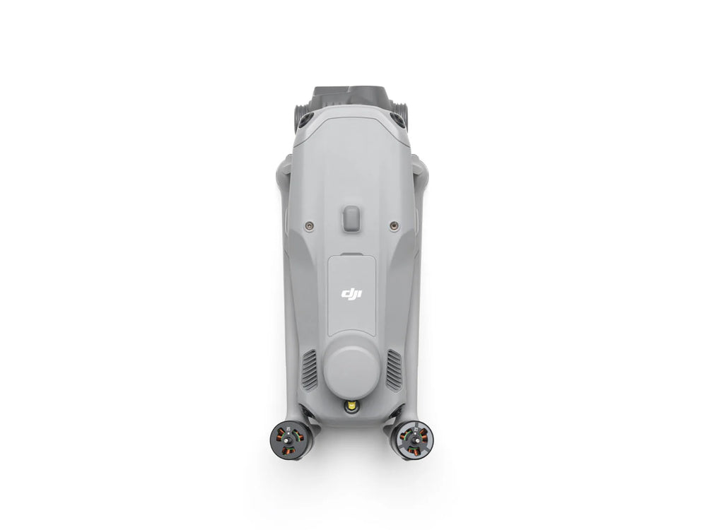
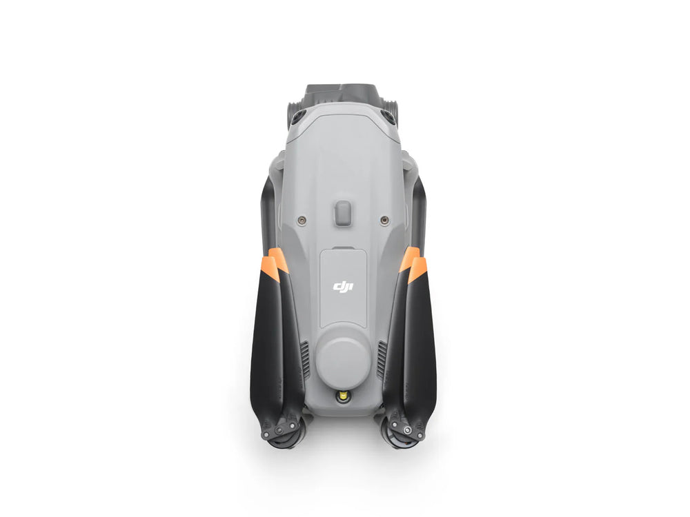
The DJI Matrice 4 Series redefines professional aerial operations with a compact, AI-powered multi-sensor design. Built for industries like public safety, utilities, surveying, and geospatial mapping, it offers unmatched imaging, measurement, and mission efficiency.
Key Features
- Multi-Sensor Payloads – wide-angle, tele, and medium tele cameras
- AI-Powered Detection – identify vehicles, vessels, and people automatically
- Precision Mapping – mechanical shutter + 0.5-second interval shooting
- Night Vision Upgrade – full-color low-light mode with noise reduction & IR support
- Extended Range, Endurance & Cruise Control for effortless long-distance flights
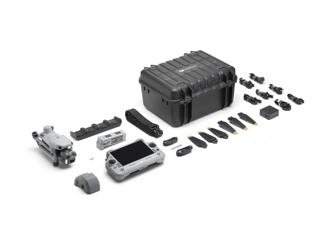
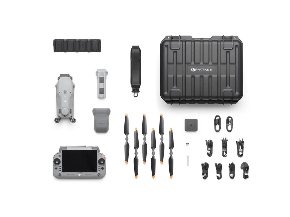
What's Included
| Category | Description | Quantity |
|---|---|---|
| Aircraft & Power Components | DJI Matrice 4E Drone | 1 |
| DJI Matrice 4 Series Intelligent Flight Battery | 1 | |
| DJI Matrice 4 Series Charging Hub | 1 | |
| DJI 100W USB-C Power Adapter | 1 | |
| 100W Power Adapter AC Cable | 1 | |
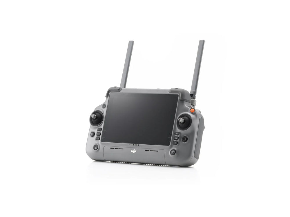
| Remote Controller & Accessories | DJI RC Plus 2 Enterprise Controller | 1 |
| USB-C to USB-C Data Cable | 1 | |
| USB-A to USB-C Data Cable | 1 | |
| Propulsion & Protection | DJI Matrice 4 Series Propellers | 3 |
| DJI Matrice 4E Gimbal Protector | 1 | |
| Storage & Transport | DJI Matrice 4 Series Storage Case | 1 |
| DJI Matrice 4 Series Storage Case Shoulder Strap | 1 | |
| Connectivity & Media | microSD Card | 1 |
| DJI Cellular Dongle 2 Pry Bar | 1 |
Product Specification
- Wide-Angle Camera: 20MP, 4/3 CMOS with mechanical shutter
- Medium Tele Camera: 48MP, 70mm equivalent
- Telephoto Camera: 48MP, 168mm equivalent
- Laser Rangefinder: Precise measurements up to 1800m
- Smart Oblique Capture (5-directional & 3-directional ortho) to cover up to 2.8km² in one flight
- Electronic Dehazing ensures clear imaging in smog, haze, or humidity
- Telephoto Precision – identify cracks, screws, or read instrument panels from 10–250 m away
- O4 Enterprise Transmission – industry-leading 25 km range with 20 MB/s bandwidth for ultra-stable data and video links
Software Compatibility
- Fusion Positioning + RTK – rapid GNSS lock, centimeter-level accuracy, and secure return-to-home even in GNSS-denied environments
- Omnidirectional Sensing – AI-assisted obstacle avoidance and terrain-aware flight paths
Product Applications
- Public Safety & Emergency Response – live situational awareness with thermal and zoom
- Infrastructure & Utilities – detailed inspections from safe distances
- Surveying & Mapping – fast, high-accuracy data capture without GCPs
- Forestry & Conservation – precise monitoring with AI detection and NIR support
- Precision-focused – mapping, surveying, construction, and mining