Loading...
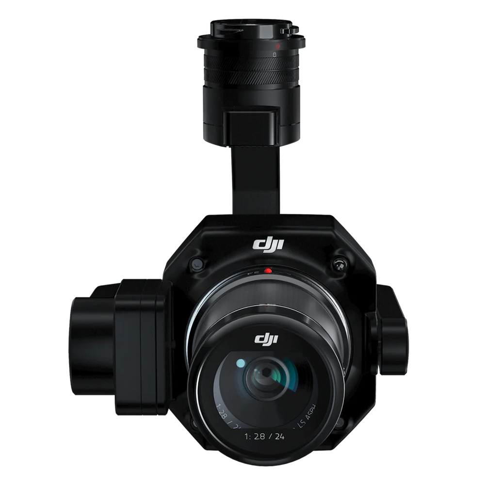
DJI Zenmuse P1 Full-Frame Survey Camera
Regular price
$7,630.00
Unit price
/
Unavailable
Shipping calculated at checkout.
DJI Zenmuse P1 Full-Frame Survey Camera is backordered and will ship as soon as it is back in stock.
DJI Zenmuse P1 Full-Frame Survey Camera
Regular price
$7,630.00
Unit price
/
Unavailable
Product Description
The DJI Zenmuse P1 is DJI’s flagship full-frame photogrammetry camera, designed to take aerial surveying and mapping to the next level. With a 45MP sensor, interchangeable fixed-focus lenses, and a 3-axis stabilized gimbal, the P1 delivers unmatched efficiency and centimeter-level accuracy—even without GCPs.
Key Features
- Smart Data Management – Auto-organized mission files with GNSS + RTK data
- Fieldwork Reports – Verify data quality and RTK status instantly after flight
-
Post-Processing Efficiency – Smart Oblique Capture reduces processing time by up to 50%
- Smart Oblique Capture – Automates angled shots for efficient 3D modeling
- High Accuracy Without GCPs
- TimeSync 2.0 – Microsecond-level synchronization for absolute precision
- Lens Options – Supports 24/35/50mm DL mount lenses for flexible missions
Product Performance
- Rapid Capture – Take a photo every 0.7 seconds in-flight
- Accuracy without GCPs - 3 cm horizontally / 5 cm vertically
- High Efficiency - 3 km2 covered in a single flight
- 45 MP Full-frame Sensor
- 4.4μm Pixel Size
- Global Mechanical Shutter - Shutter Speed 1/2000 Seconds
Product Applications
- Topographic Mapping – Generate survey-grade maps without GCPs
- Cadastral Surveys – Centimeter-level accurate 3D models
- AEC & Construction – Plan, monitor, and manage projects with 2D/3D data
- Natural Resource Management – Forest, water body, and land analysis
- Geological Studies – Safely survey hazard zones with high-precision data
- Disaster Response – Real-time mapping of affected areas for faster decisions