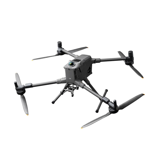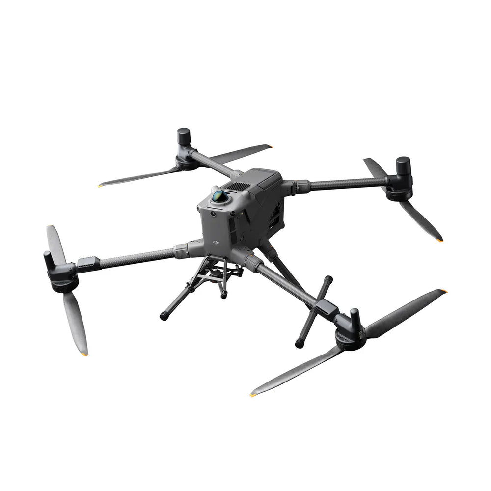
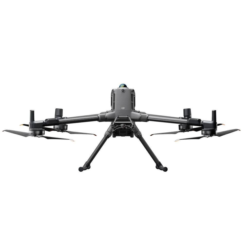
DJI Matrice 400 Multi-Payload, Long Distance, Precision Drone
DJI Matrice 400 Multi-Payload, Long Distance, Precision Drone is backordered and will ship as soon as it is back in stock.
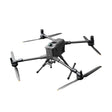
DJI Matrice 400 Multi-Payload, Long Distance, Precision Drone
Product Description
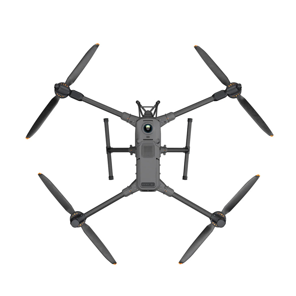
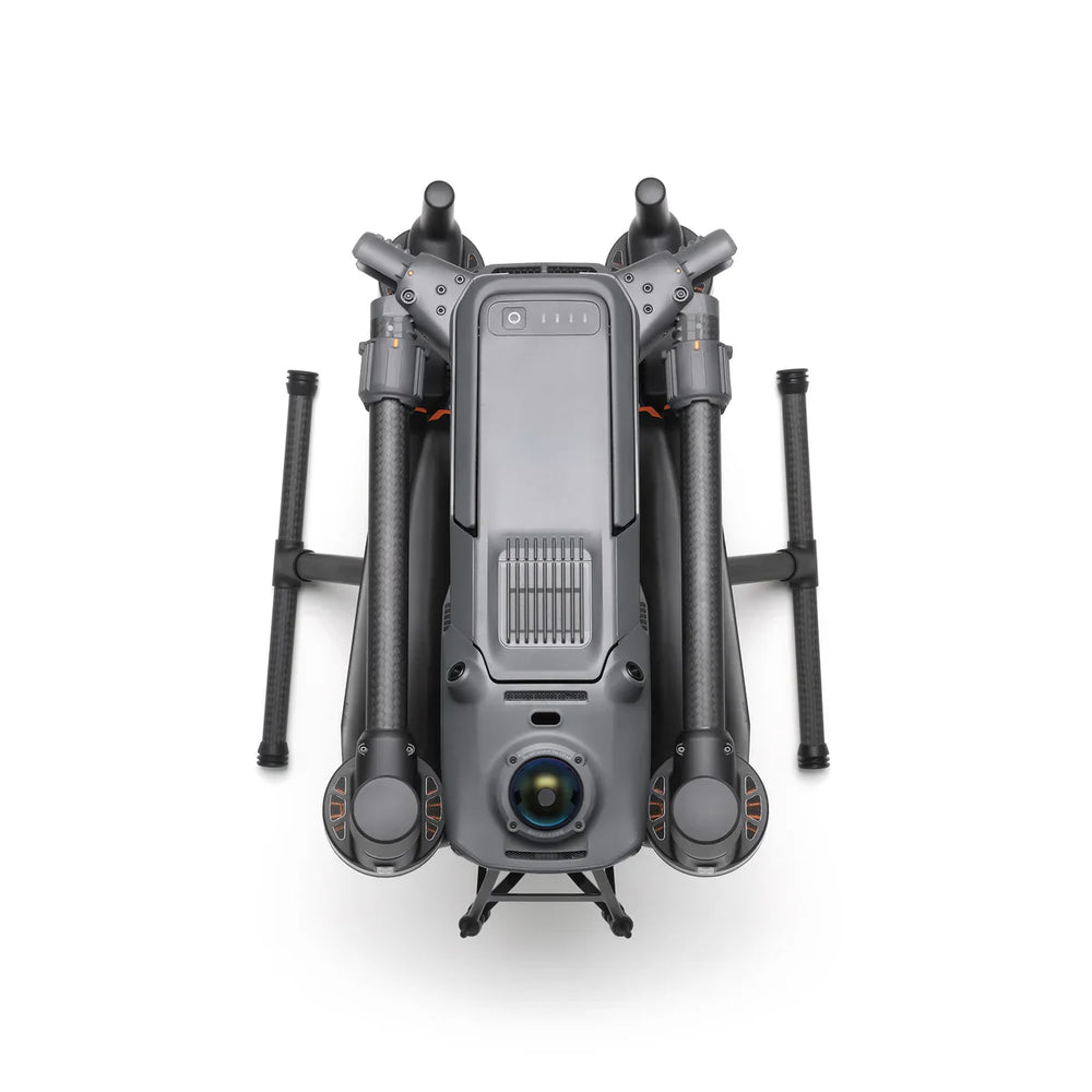
Experience unmatched performance and reliability with the DJI Matrice 400, built for professional and industrial missions. This powerhouse offers up to 59 minutes of flight time¹ and supports payloads up to 6 kg², making it ideal for demanding operations across inspection, mapping, and emergency response.
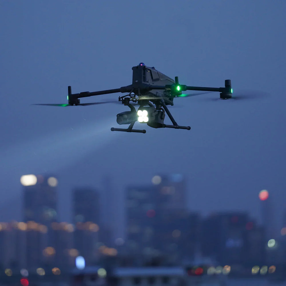
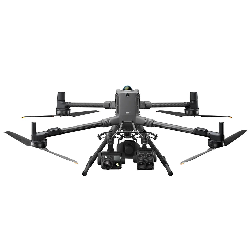
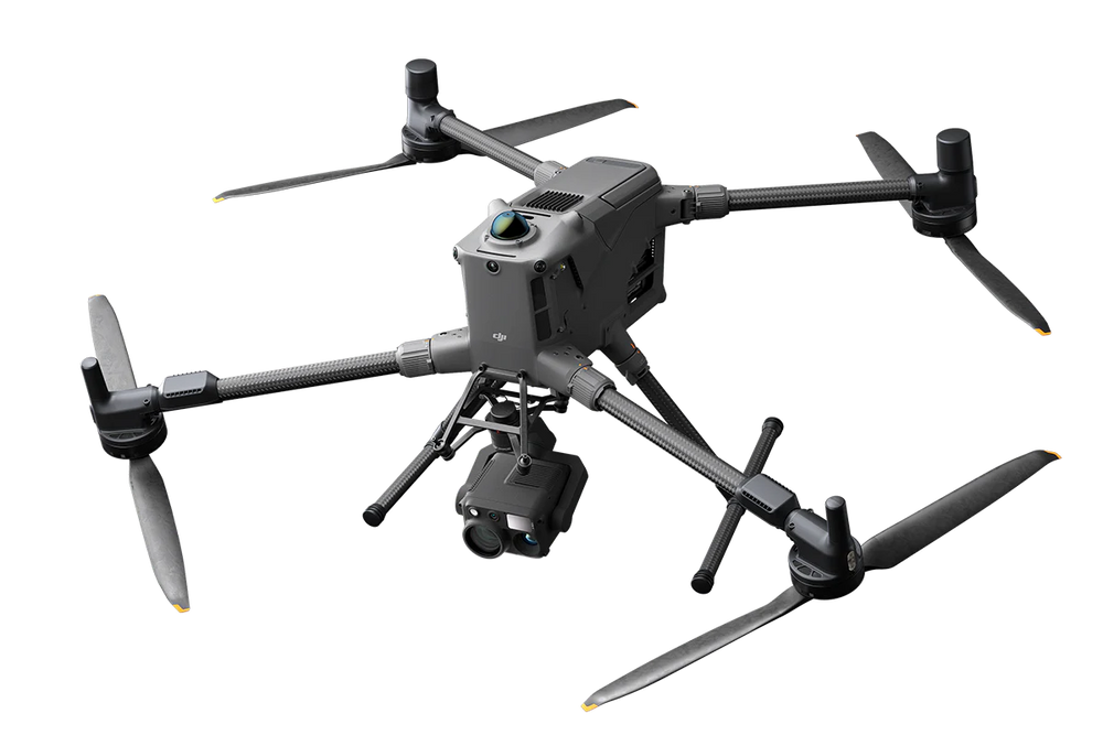
Equipped with integrated rotating LiDAR and mmWave radar, the Matrice 400 delivers power-line-level obstacle detection³ for unparalleled situational awareness. With O4 Enterprise Enhanced Video Transmission and Airborne Relay Video Transmission⁴, operators enjoy seamless, secure connectivity in complex environments.
From visible and thermal imaging to Smart Detection, AR projection, and ship-based takeoff and landing, every feature is designed to enhance safety and efficiency. Whether you’re tackling power line inspections, public safety missions, or AEC projects, the DJI Matrice 400 sets a new benchmark in enterprise drone performance.
<<High Capacity, Intelligent Battery Sold Separately>>
<<Shown with Optional Zenmuse Payloads Sold Separately>>
Key Features
🚀 Extended Flight Time & High-Speed Performance
- Stay in the air longer with up to 59 minutes of forward flight or 53 minutes of hover time, maximizing mission efficiency and coverage on every operation.
💪 Heavy-Lift Payload Capacity
- Carry more with confidence — support up to 6 kg of total payload and operate with up to seven simultaneous payloads, ideal for multi-sensor or dual-camera setups.
🛡️ Safe & Reliable Flight Systems
- Fly smarter and safer using an integrated rotating LiDAR, mmWave radar, and full-color low-light vision system for precise obstacle detection and situational awareness in all conditions.
🧠 Intelligent Mission Efficiency
- Experience Smart Detection and AR Projection for enhanced data accuracy, real-time visualizations, and faster decision-making in complex environments.
⚙️ Fully Automated Operations
- Streamline workflows with native DJI Pilot 2 quick-task templates, enabling seamless automated missions and repeatable precision flight paths.
What's Included
| Description | Quantity |
|---|---|
| Matrice 400 Aircraft (with Propeller Holder) | 1 |
| Remote Controller — DJI RC Plus 2 (with Sub-2 G SDR Module) | 1 |
| WB37 Battery (for RC) | 1 |
| Carrying Case | 1 |
| Landing Gear | 2 |
| Propeller Pair | 2 |
| Propeller Washers and Screws | 6 |
| Remote Controller Strap & Bracket | 1 |
| USB-C ↔ USB-C Cable | 1 |
| Power Cable | 1 |
| Gimbal Damper | 4 |
| Screws & Tools Set | 1 |
| Cleaning Tools Set | 1 |
| Rubber Port Covers & Screws Set | 1 |
Product Specifications
⚡ Flight Performance
- Up to 59 min forward flight / 53 min hover — even with payload attached
- Ideal for firefighting, search & rescue, and large-scale mapping missions
- Max speed: 55 mph (25 m/s)
- Advanced LiDAR + mmWave radar obstacle sensing actively scans for terrain, towers, and structures
- Stable, long-range flight for uninterrupted mission coverage
💪 Payload Capacity & Configuration
- Maximum payload capacity: 6 kg (13.2 lb)
- Supports single or dual downward gimbals
- Includes third lower gimbal mount for additional flexibility
- Four external E-Port V2 connectors for multi-device integration
- Up to 7 simultaneous payloads for multi-sensor operations
🔗 Payload Compatibility
- Fully compatible with DJI Zenmuse H30, H30T Thermal, L2 LiDAR, P1 camera, S1 Spotlight, V1 Speaker, Manifold 3, and third-party payloads
- RTK & Positioning: D-RTK 3 Multifunctional Station, D-RTK 2 Mobile Station
- Ecosystem & Developer Ports: DJI X-Port, DJI E-Port V2 Development Kit, DJI E-Port V2 Coaxial Cable Kit, DJI SkyPort V3 Adapter Set, DJI SkyPort V3 Coax. Cable Kit
- Modular ecosystem enables fast customization for specialized applications
Product Applications
- Firefighting – locate hotspots and monitor fire spread
-
Search & Rescue – detect missing persons in difficult terrain or low light
- Utility Inspections – analyze power lines, substations, and solar panels
- Roof & Building Inspections – reveal leaks, insulation issues, or structural defects
- Precision Agriculture – monitor crop health and irrigation efficiency
- Security & Surveying – real-time surveillance and monitoring
- Cell Tower & Bridge Inspections – Capture detailed data without risking human safety.
- Wildlife & Resource Protection – Observe animals and habitats with minimal disturbance.